
Towering at the southern end of the Salt Lake Valley, Lone Peak is an epic hike that rewards you with stunning views and pristine wilderness. If you have a good amount of hiking experience and are looking for a worthy challenge, it can be hard to find truly epic hikes that aren’t several-hour-drives from civilization.
Lone Peak is a very strenuous and technical hike, and I’d recommend only attempting it if you’re at least moderately fit and only bringing kids twelve and older. This hike definitely isn’t for anyone afraid of heights as it involves serious exposure and boulder-crawling near the top. For families with older kids and hiking experience, though, Lone Peak is an epic adventure that you’ll remember for a lifetime.
If you’re up for the challenge, I think this is the crowning hike of the Wasatch Front. We’ll dive into everything you need to know to tackle this giant of the Wasatch.
Trail Details
There are at least six different routes to get to the top of Lone Peak, but I’m going to focus on the Jacob’s Ladder Trail because it is the most straightforward and scenic, and the least dangerous. For your first time climbing Lone Peak, this is by far the best trail because the other routes involve difficult route-finding and more technical scrambling.
Distance: 15.6 miles
Difficulty: Challenging
Elevation Gain: 5,556 ft
Dogs Allowed: No
Alltrails Link
Trail Location
The trail starts at the Peakview trailhead which is just off the top of Suncrest Drive between Draper and Alpine. This trailhead is super easy to access and is less than 15 minutes from the freeway.
The trailhead has been rebuilt in the last few years, and there is a large parking lot with plenty of room to park. I’ve never seen it fill up, but if it does, there’s easy overflow parking along the road. You’ll want to start this hike pretty early in the morning anyway, so there will likely be lots of room.
Once you arrive at the trailhead, walk to the south end of the parking lot and look for signs for the Peakview Trail. The beginning is quite easy to find.
Trail Description
The first section of the hike along Peakview Trail is fairly easy with a well-maintained dirt trail that is relatively flat along the rolling foothills. Consider this your warm-up before the real work begins. Around 1.5-2 miles, start looking for signs pointing toward Jacob’s Ladder.
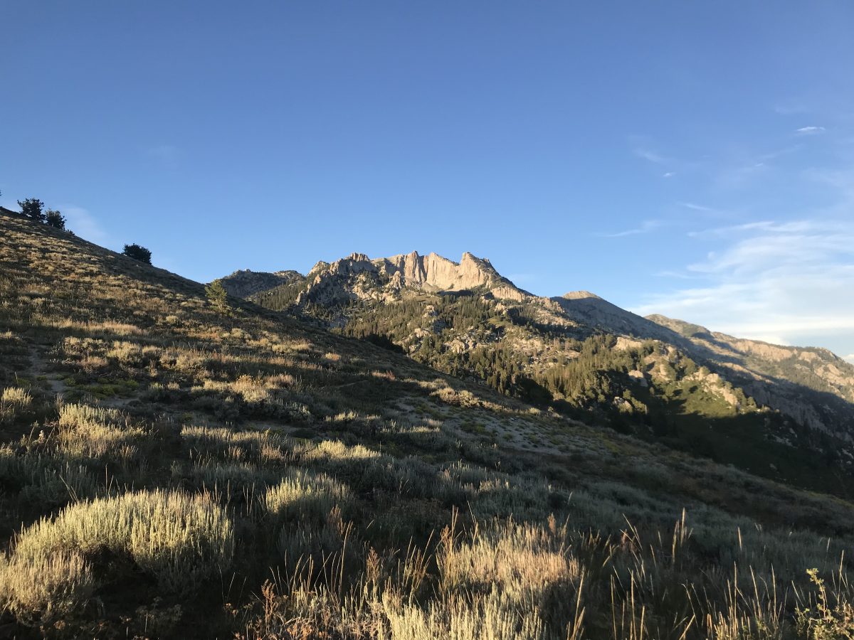
From here, the trail starts getting steeper. You climb up a small section of dirt double-track, and then the trail opens onto a small, rocky ridge, joining in with the Jacob’s Ladder trail. Once you get onto the ridge (around mile 2), you follow it for another half a mile before passing a landmark called Lone Rock. This is a large rocky outcropping at the top of the ridge and is a great viewpoint looking south across Utah Valley or up to the peak.
From here you enter more tree cover, mainly mountain mahogany and scrub oak. A short walk brings you to a fork in the trail and a sign saying you are entering Lone Peak Wilderness. From here you need to follow the sign to stay left on the Jacob’s Ladder Trail.
In 2021, the section of the trail from Lone Rock to Ennis Peak was rebuilt to add more switchbacks, so it’s not as steep as it used to be. It’s still a relentless climb though: you gain 2,000 feet in under 2 miles.
When you get to the top of this massive climb, the trail skirts around Ennis, peak, a rounded point on the flank of Lone Peak. The trail levels out for a while as you pass down the ridge from Ennis Peak and through a few wide-open meadows. In one of the meadows, the trail crosses a small seasonal stream that’s usually dry by late summer.
After the stream crossing, you enter the pines for a short section and the trail starts climbing again. Enjoy the shade here, because most of the hike is fully exposed to sun.
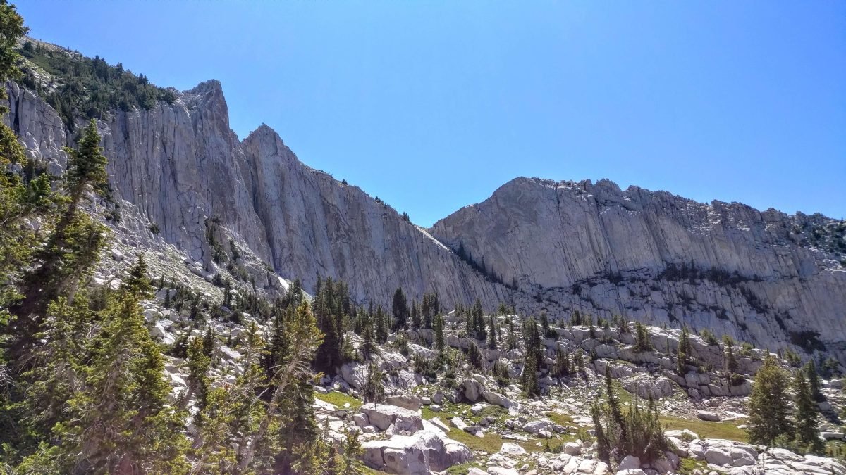
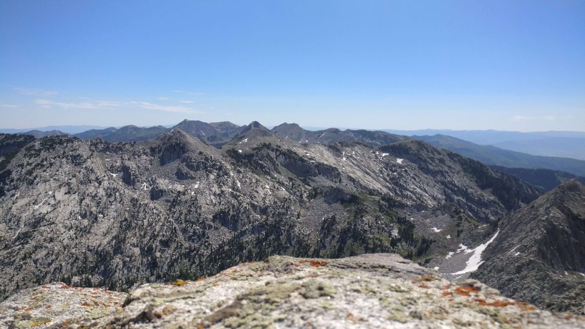
The route quickly opens up again onto a massive open granite slab. This is one of my favorite sections of the hike as you traverse this stunning granite face with incredible views of the Lone Peak above you and a wide-open panorama to the south.
Because it’s bare rock, there is no distinct trail. Rather you’ll be following a series of cairns. Some of these rock piles are huge—five to six feet tall—so they aren’t hard to find. You’ll be able to see the peak the whole time, and if you keep a beeline toward it, you’ll go in the right direction.
Through this section, make sure you keep note of the route for the way back down. It’s fairly easy to go too low on the descent and end up in a canyon that drops to Alpine. Over the granite face, when in doubt, stay high.
The most difficult navigation comes after the top of the granite face. You enter a narrow ravine and the slope starts to close in on either side. It’s very easy at this point to just continue straight up the ravine. In fact, every time I’ve hiked Jacob’s Ladder, that’s exactly what I did.
The problem is that this route leads you into a large boulder field that’s too far right from where you actually want to go. Once the ravine starts to become very narrow, you need to turn to your left and follow a series of cairns up a steep series of massive granite steps.
Around mile 7, as you walk through the ravine, keep your eyes out for cairns and a trail up on the left. If you see a large, jumbled boulder field ahead and the cliffs to your left start becoming impossibly steep, you’ve gone to far.
The turnoff is easy to miss, but if you keep your eyes out, you should find the cairns marking the way on the left.
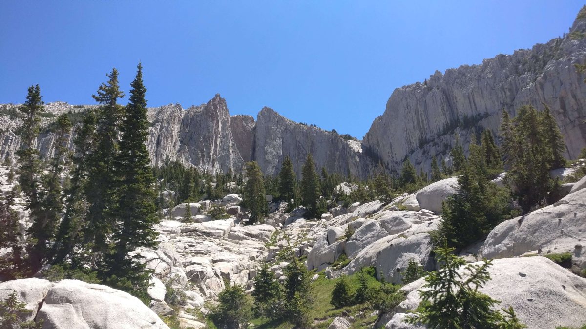
From here you start the brutal climb into the Lone Peak Cirque. A cirque is an amphitheater-like valley formed at the top of a glacier path. The cirque formed on Lone Peak is breathtaking. You are surrounded by colossal granite cliffs on either side, and it feels like a little world of its own.
The climb into the cirque is steep and not well marked. You should be able to see the peak ahead of you, and if you keep heading slightly to the left, you’ll end up in the right spot.
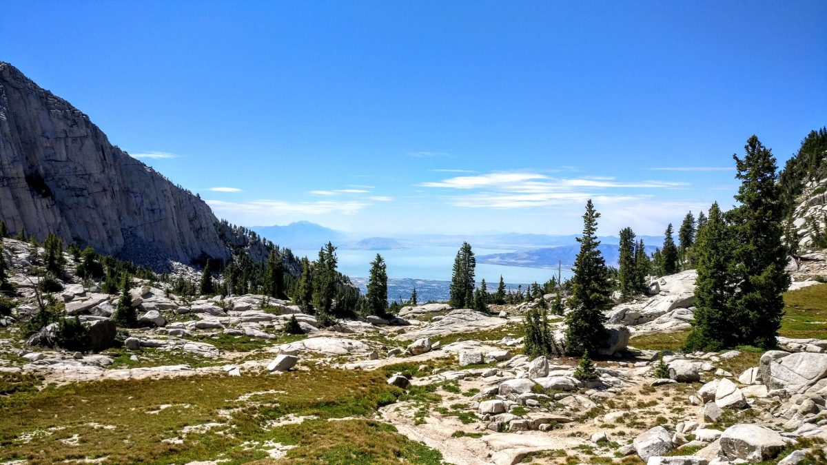
Soon the steep granite gives way to a series of grassy alpine meadows in the heart of the cirque. This is one of my favorite places on earth with its expansive views, enclosing cliffs, and local mountain goat herd.
From the grassy meadows in the cirque, the trail can be hard to find. It seems like you have to scale an impossible wall of rock before reaching the peak. The trick is to stay left. If you head to the far north end of the grassy meadows, you’ll find a steep narrow gully that skirts left of the sheer cliffs.
It looks impossible until you get right up to it, but there are some cairns and a faded trail marking the way. It’s steep and loose, so be careful.
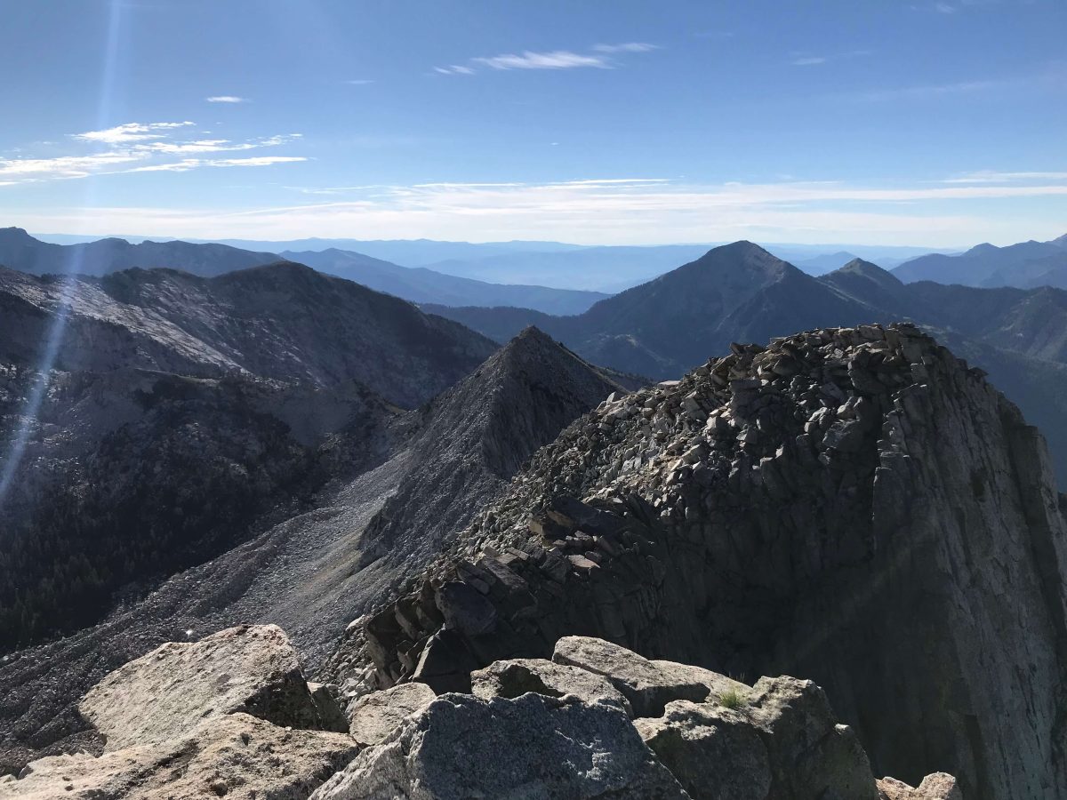
Once you get to the top of the gulley, you will find yourself on the summit ridge. From here it’s only a quarter mile to the top, but it is steep, technical, and highly exposed. There is a distinct trail for a little while, but it disappears as the rocks get bigger.
Toward the top, you will be scrambling over and around schoolbus-sized chunks of rock. Make sure you stay just on the left side of the ridgeline. The right side is a sheer dropoff into the cirque. You also don’t want to get too far down the left side, so hug close to the ridge.
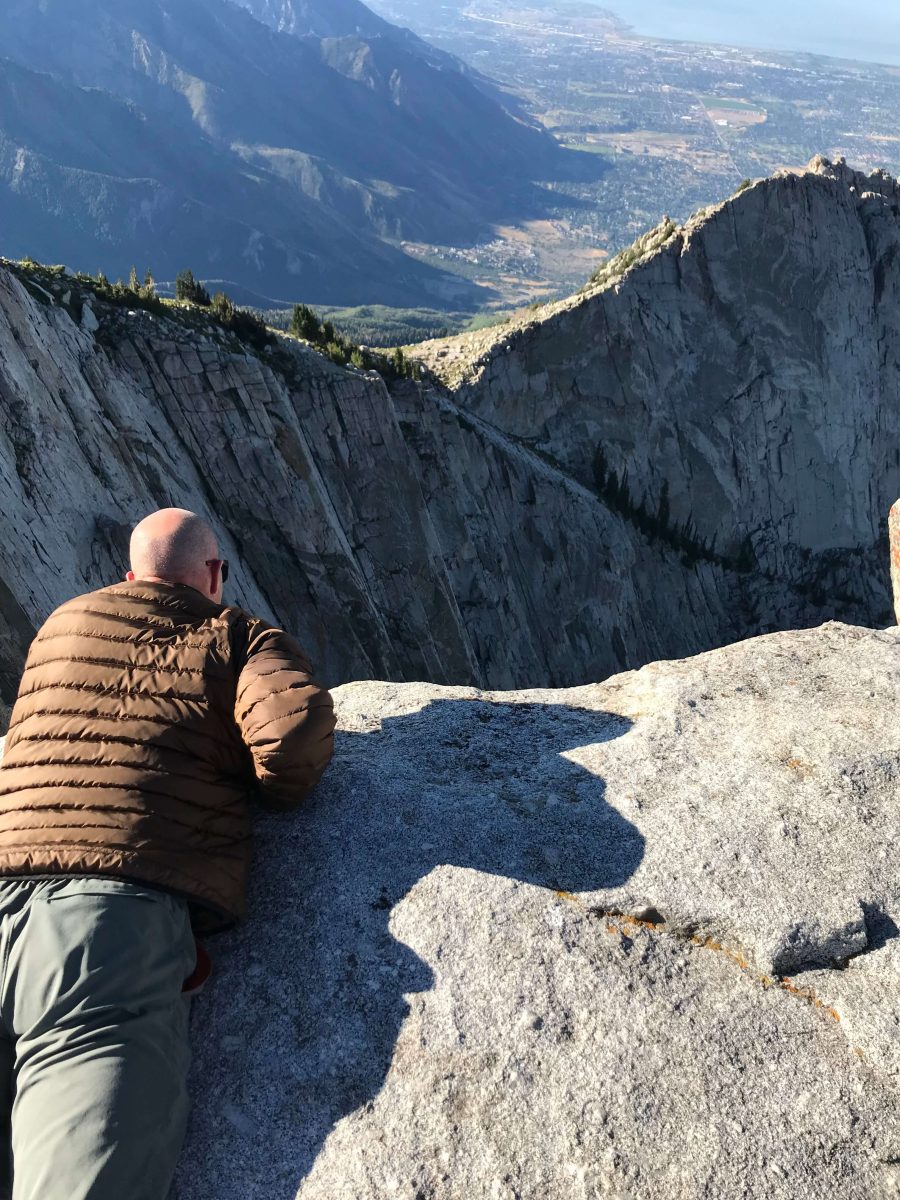
The summit itself is a narrow spire of rock towering over the cirque. You arrive at a roughly 15-ft square platform of granite surrounded by sheer 700-ft sheer dropoffs.
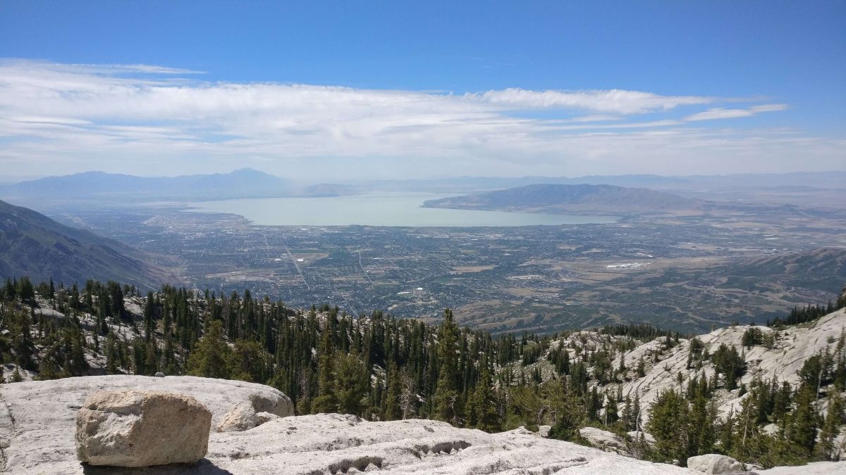
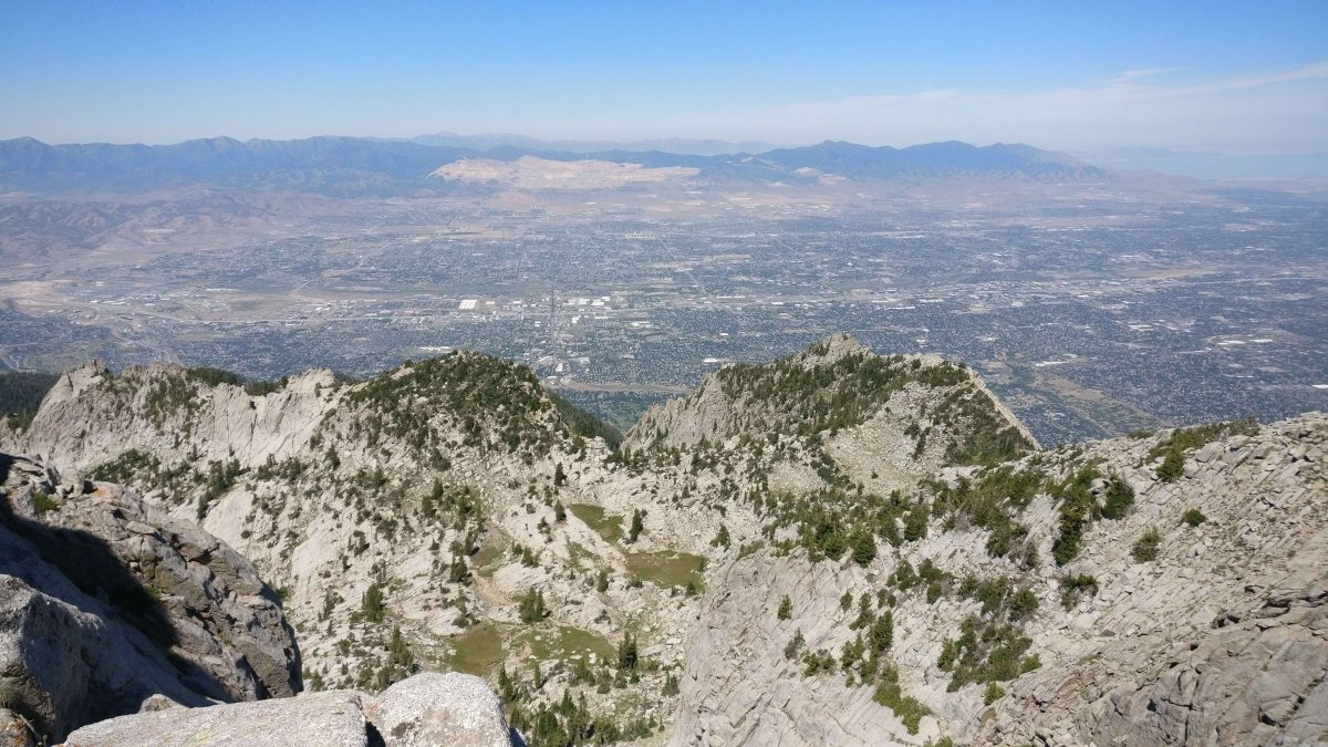
The views are stunning in every direction. You can look out to both Utah and Salt Lake Valleys. Turn south to see Timpanogos and Mount Nebo in the distance. To the East, you can look back along the Alpine ridge toward Snowbird and Alta. The High Uintas Wilderness is barely visible in the far distance.
Enjoy the views, eat lunch, and make sure your legs are rested for the long, knee-pounding descent back down.
When To Hike Lone Peak
Hiking Lone Peak is best during late summer to early fall. There can still be significant snow on the upper slopes through June, and in October you start seeing early-season storms. The best season to hike the trail is from late July to mid-September.
In my experience, the best time to hike Lone Peak is early-to-mid September. There’s a lower risk of encountering monsoon-season storms, and the temperatures are a bit cooler than in full summer.
You should plan on this hike taking about 8-12 hours, maybe a bit faster if you’re in fantastic shape and are speed-hiking. It’s definitely best to get an early start. If you can be at the trailhead before sunrise, you’ll make it past the lower sun-exposed sections before the day heats up.
Tips For Hiking Lone Peak With Kids
This definitely is not a hike for small kids. I would say twelve and up is a good age range for hiking Lone Peak. The sheer difficulty of this climb combined with some tricky route-finding and scary sections near the top make this a better hike to do with teens who have significant hiking experience.
The biggest thing to be aware of is the exposure and technical sections at the top. The last few hundred yards involve some tricky boulder crawling with steep dropoffs to one side and sheer cliffs on the other. The peak itself is fully exposed with 700-foot cliffs on three sides and not much margin for error.
Your hands will be busy keeping yourself stable, so you need to be sure any kids or teens doing the hike with you are surefooted, responsible, and capable of staying safe themselves.
If you want to get a taste of the hike with smaller kids, there are several destinations along the way that would make for fantastic shorter hikes. Hiking to Lone Rock is about five miles round trip and avoids the most difficult climbing while getting to a great viewpoint.
Ennis Peak is another amazing viewpoint that would make for an eleven-mile roundtrip hike. For kids under twelve who are up for a challenge, Ennis Peak is an incredible all-day adventure in it’s own right.
About The Author: Jakob Withyr is an outdoor adventure seeker who collects sunburns, National Park maps, and trail miles. I love anything that gets me outdoors, whether it’s on foot, on skis, on a bike, or on the open road. A Utah native, I’m most at home in mountains and deserts with clear air and bright stars.